
Tibet is a high-altitude region on the Tibetan Plateau at the meeting point of Central, South, and East Asia. On a modern political map, the Tibet Autonomous Region lies in southwestern China and has Lhasa as its capital. The physical plateau is much larger, while Tibetan cultural and linguistic regions also extend into parts of Qinghai, Sichuan, Gansu, and Yunnan and connect with Himalayan and diaspora communities.
That is why “Where is Tibet?” has more than one useful answer. The word can refer to a present administrative region, an immense landform, or a wider cultural world shaped by Tibetan languages, histories, art, pastoral and agricultural life, and religious traditions. Naming the meaning first makes every later conversation clearer—and leaves room for the people who call these landscapes home.
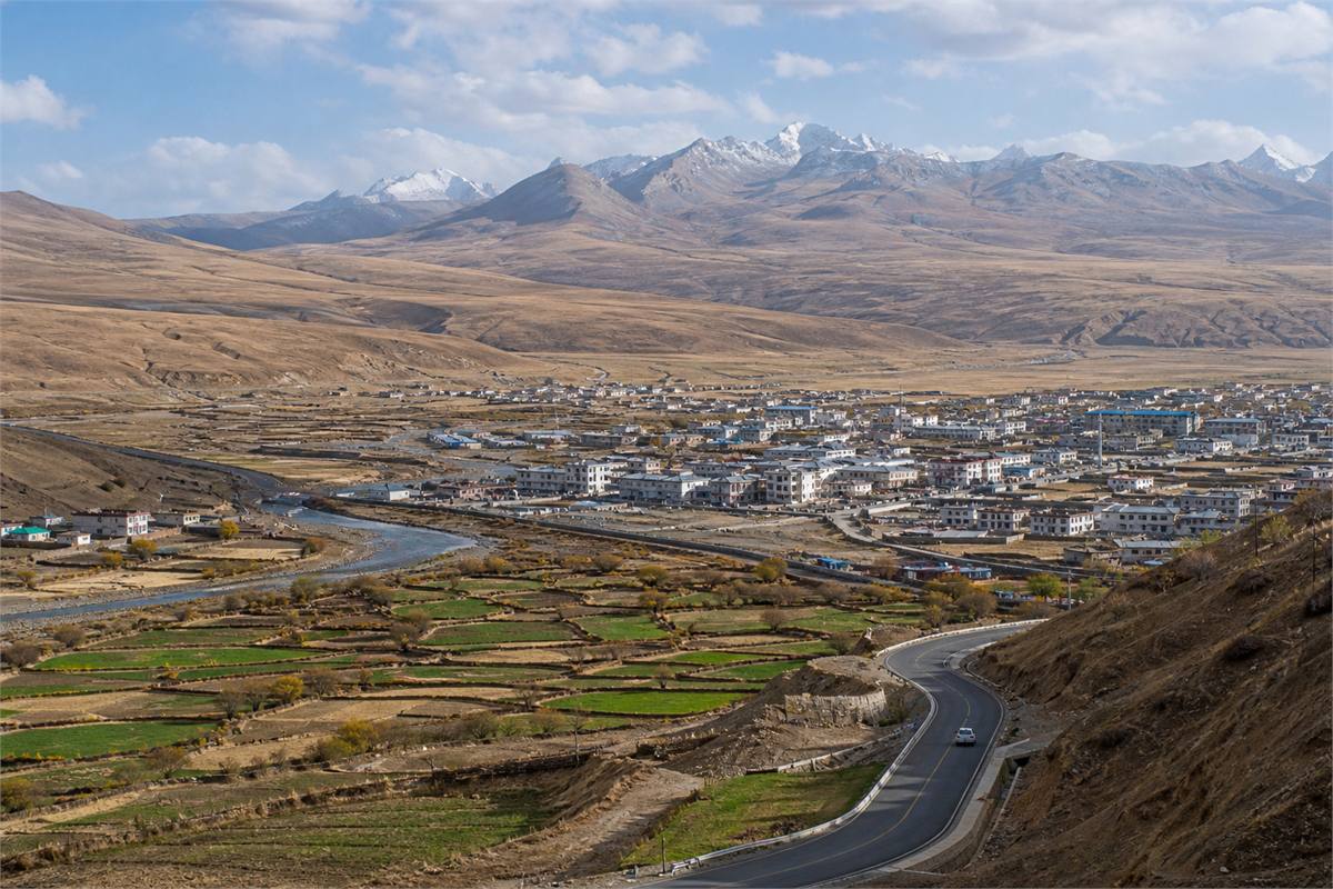
Tibet on a map: three geographies to distinguish
| Map term | What it describes | Why it matters |
|---|---|---|
| Tibet Autonomous Region | A present administrative region in southwestern China | This is the boundary used on current political maps |
| Tibetan Plateau | A vast elevated landform extending well beyond one administrative region | Physical geography and administrative geography are not the same |
| Tibetan cultural regions | Overlapping historical and linguistic geographies often discussed through Ü-Tsang, Kham, and Amdo | Cultural relationships cross today’s provincial boundaries |
The Tibet Autonomous Region should therefore not be treated as a synonym for every Tibetan-speaking place. Nor should the whole Tibetan Plateau be described as a single cultural unit. The plateau includes many environments and communities, and related Tibetan traditions have also been sustained beyond it through travel, trade, religious institutions, education, and migration.
Why the Tibetan Plateau is called the Roof of the World
Much of the plateau lies above 4,000 meters. The Himalayas border it to the south, while other major mountain systems and broad uplands stretch across its interior and edges. Lhasa itself stands at roughly 3,650–3,700 meters. Lower air pressure, strong ultraviolet exposure, cold nights, dry conditions, and rapid weather changes shape travel as well as architecture, farming, herding, clothing, and daily rhythm.
“Roof of the World” is a memorable geographic phrase, but Tibet is not an empty panorama above the clouds. It holds cities, villages, farms, grasslands, monasteries, schools, markets, roads, and carefully tended homes. Elevation is a lived condition. Generations of residents have developed local knowledge for working, celebrating, caring for families, keeping animals, and moving through different seasons.
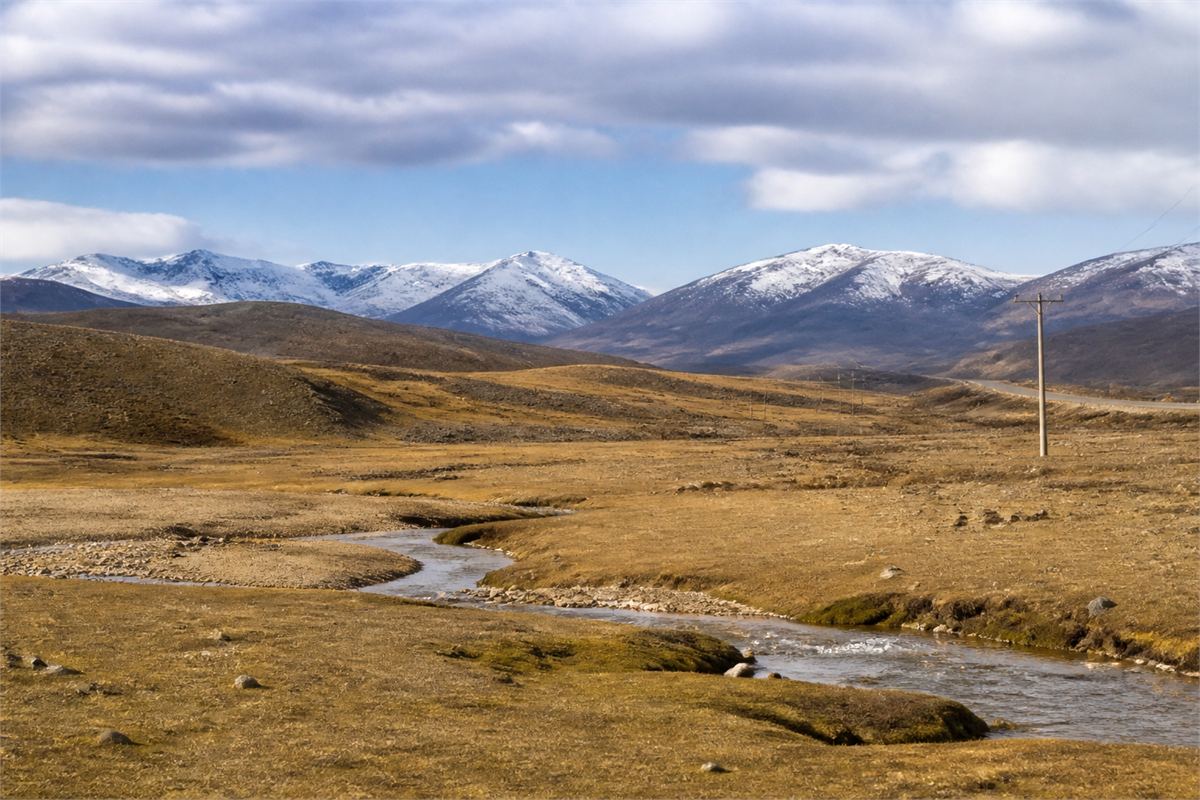
Rivers, lakes, and the geography of Asia
The wider Tibetan Plateau is often called an Asian water tower because it contains or adjoins the headwater regions of major river systems. These include the Yarlung Tsangpo–Brahmaputra, Indus, Sutlej, Mekong, Salween, Yangtze, and Yellow rivers. Their sources are distributed across the broader plateau; it would be inaccurate to say that all of them begin inside the Tibet Autonomous Region.
Glaciers, snow, permafrost, wetlands, monsoon patterns, and grasslands influence water far downstream. Lakes such as Namtso, Yamdrok, and Manasarovar also carry ecological and cultural importance. Around some mountains and lakes, pilgrimage, community life, conservation, and tourism share the same fragile terrain. A respectful journey recognizes both the sacred relationship and the living ecosystem.

Lhasa and a living pilgrimage landscape
Lhasa is the best-known Tibetan city and an important religious, historical, administrative, and commercial center. The Jokhang Temple and Barkhor circuit form a living devotional heart, where pilgrims may perform kora—circumambulation—turn prayer wheels, make offerings, or prostrate. These acts are part of religious life, not a display arranged for visitors.
The Potala Palace rises above the Lhasa Valley as an architectural and historical landmark. The UNESCO World Heritage property brings together the Potala Palace, Jokhang Temple, and Norbulingka. Each place has its own access, security, photography, and visitor requirements, so current on-site instructions matter more than a universal rule copied from a travel list.

Ü-Tsang, Kham, and Amdo are cultural regions, not modern provinces
Ü-Tsang, Kham, and Amdo are widely used historical, linguistic, and cultural concepts. Ü-Tsang is commonly associated with central and western areas, Kham with eastern areas, and Amdo with the northeast. Their boundaries, meanings, and local uses have shifted over time, and today they overlap several administrative regions.
These names are best used as guides to diversity rather than ranks of authenticity. No one region is the single “true” center of Tibetan culture. Dialects, dress, food, architecture, music, pastoral and agricultural practices, monastic institutions, and artistic schools differ within as well as between them. When describing a thangka, textile, silver ornament, mural, song, or ritual object, a precise place, community, workshop, or maker is more helpful than a generic “Tibetan” label.

Why Tibet is regarded as sacred
Tibetan Buddhist traditions have shaped a dense sacred geography of monasteries, hermitages, pilgrimage circuits, mountains, lakes, caves, teachers, and remembered events. Bon traditions and local relationships with land are also important. Sacredness is carried through narratives and ritual, but also through repeated journeys, study, care for places, and community memory.
Mount Kailash, for example, is sacred in several religious traditions, and the routes around it are journeys of devotion for many pilgrims. The significance of a sacred mountain or lake depends on the tradition and the people who approach it. Visitors can honor that meaning without turning worshippers into scenery or treating a religious space as a personal photo set. For a closer foundation, read our introduction to Tibetan Buddhism.

Language, literature, and art across Tibetan communities
Tibetic languages belong to the Sino-Tibetan language family. Spoken varieties are diverse, and differences do not fit perfectly inside three neat regional boxes. Written Tibetan has supported religious, historical, medical, literary, and administrative traditions for centuries; modern usage also varies by place and context.
Tibetan literature includes religious and philosophical writing, biography, history, poetry, and oral and written forms of the Gesar epic. Visual and performing traditions include thangka painting, murals, sculpture, manuscript arts, metalwork, textiles, architecture, music, dance, and Tibetan opera. Thangkas follow iconographic and workshop traditions rather than serving as generic decoration, while Tibetan opera includes multiple regional forms and performance lineages.
Objects can carry wishes for protection, clarity, compassion, wisdom, harmony, and safe passage. They express a wish—a medium through which people hope to bring about wealth, health, virtue, longevity, or a specific outcome in life. Understanding where an object comes from allows that blessing to remain connected to its makers and cultural setting. Our guide to Tibetan prayer flags offers one object-specific example.

High-altitude health: recognize when to stop and descend
Travel to Lhasa and higher destinations can involve a rapid jump in sleeping altitude. The CDC Yellow Book 2026 guidance emphasizes gradual ascent: once above 3,000 meters, increase sleeping altitude slowly and build in acclimatization time. Individual risk varies, so people with heart or lung conditions, sleep apnea, previous severe altitude illness, or other medical concerns should speak with a clinician familiar with high-altitude medicine before travel.
A headache after recent ascent together with nausea, dizziness, unusual fatigue, poor appetite, or vomiting can indicate acute mountain sickness. Stop ascending and rest at the same elevation. If symptoms worsen despite rest or treatment, descend. Confusion, loss of coordination, extreme drowsiness, breathlessness at rest, chest congestion, or a cough with frothy or bloody sputum are emergency signs associated with high-altitude cerebral or pulmonary edema. Descend urgently and seek emergency medical care. Oxygen can support treatment, but a small portable can is not a substitute for descent or medical help.
Medication for prevention or emergency treatment should be discussed with a qualified clinician. Herbal supplements, fixed water targets, glucose, painkillers, or a promise that one lower-elevation stop will guarantee acclimatization should not be used as a safety plan.

Travel rules and access can change
Travel-rule check: 6 August 2026. Current UK government travel guidance says foreign visitors need a Tibet travel permit arranged through a specialist travel agent in China and must travel on an organized tour; it also warns that permit issuance or access to some Tibetan autonomous areas can change without notice. Passport, visa, permit, border-area document, route, and nationality requirements should therefore be confirmed with the relevant authorities and the licensed operator handling the trip before booking and again before departure.
Opening hours, reservations, roads, weather closures, and temple photography policies are similarly local and changeable. China’s national rules for civil drones include real-name registration and controlled-airspace restrictions, while local security, heritage, protected-area, and site rules can be stricter. Do not fly a drone based only on an app map or a general travel blog; obtain current local confirmation and any required authorization.

How to travel with care
- Ask before photographing people, ceremonies, worship, interiors, or sacred objects; a ticket is not blanket consent.
- Follow the direction, dress, access, and photography instructions posted at each temple or pilgrimage circuit, and do not block worshippers.
- Do not touch ritual objects, murals, scriptures, offerings, prayer wheels, or other sacred items unless invited.
- Do not add prayer flags, build stone piles, collect plants or stones, or enter restricted land without clear local permission.
- Keep distance from wildlife, carry out waste, stay on permitted routes, and avoid disturbing fragile high-altitude soils and wetlands.
- Choose craft with clear information about the maker, material, workshop, and place rather than relying on an exotic label.
Respect is not a performance of perfect etiquette. It begins with paying attention: residents and pilgrims may have different purposes from visitors, and local instructions take priority over generalized rules. A quieter pace helps both with altitude and with seeing a place as someone’s everyday world.

Tibet in Eastern Story
Eastern Story uses Tibetan and Himalayan labels only when an object, practice, or story is genuinely connected to them. A ritual bell, thangka, prayer flag, textile, or silver ornament deserves its own material and cultural context. Browse the Story archive for object-specific guides that keep meaning close to place, makers, and living tradition.

Conclusion
Tibet is a present place and a layered geography: the Tibet Autonomous Region on modern maps, the wider Tibetan Plateau as a landform, and overlapping cultural regions whose languages and traditions cross administrative boundaries. Its sacred landscapes hold histories of pilgrimage, learning, art, memory, and community care. Accurate geography is the beginning; thoughtful attention lets the people, places, and traditions speak with greater clarity. May every journey there be approached with patience, safety, and respect.
Frequently Asked Questions
Related Posts


